ArcGIS Feature Layer
It is possible to add up to 5 ArcGIS feature layers as reference layers in Icon Map Pro.
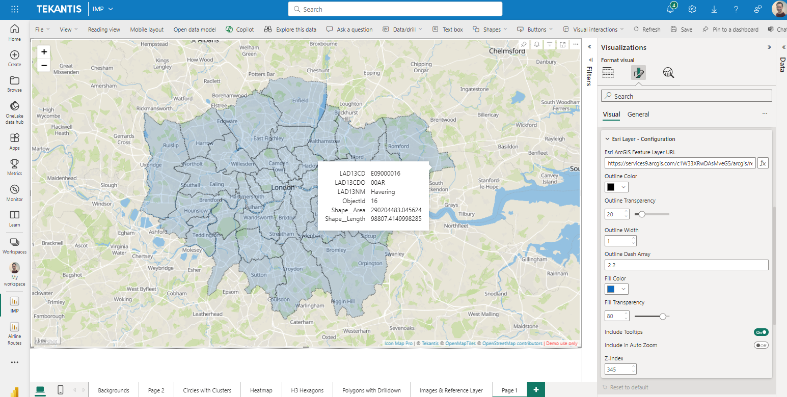
Ensure that ArcGIS authentication has been configured before configuring a feature layer.
Please note that ArcGIS Feature Layers are not currently supported when WebGL Rendering mode is enabled.
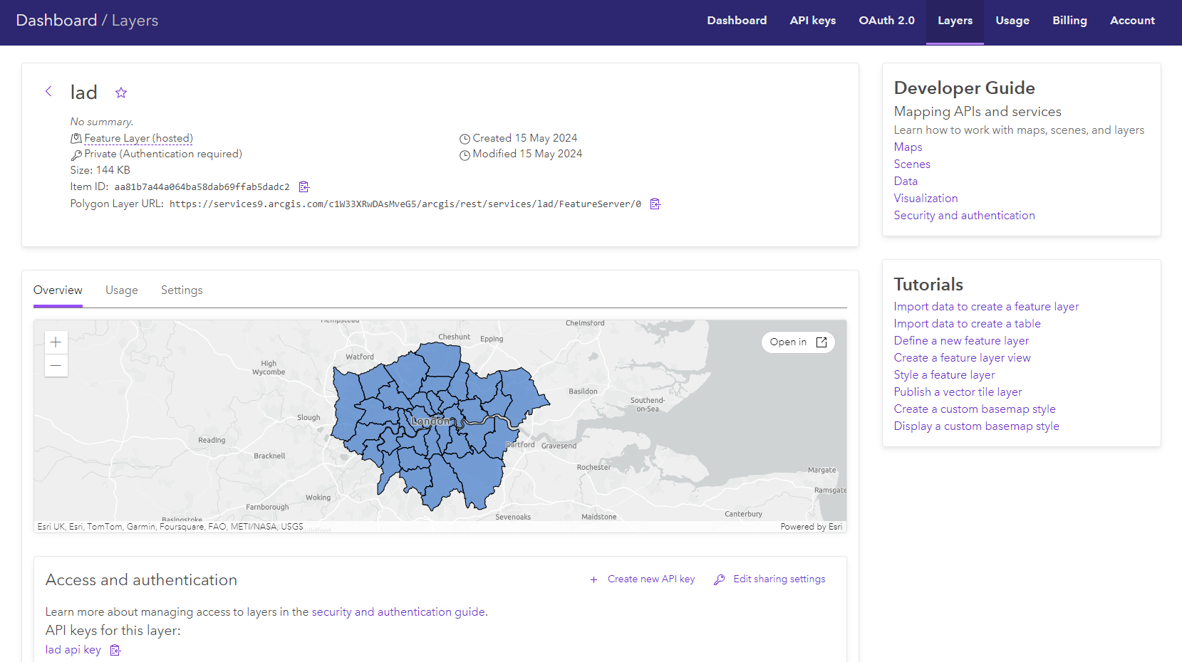
Configuration and formatting options
Esri ArcGIS feature layer URL
Copy the Polygon Layer URL for the feature layer, and paste it into the "Esri ArcGIS feature layer URL" box in Icon Map Pro. The URL can be specified as a Power BI measure to allow it to be dynamically selected.

Visible
Whether the layer should be shown or not. This can be set using conditional formatting ('yes' or 'no') to dynamically display a layer according to your data context or a Power BI slicer.
Outline Color
The color for polygon outlines and linestrings.
Outline transparency
A value between 0 and 100 representing the transparency percentage of the outline.
Outline width
The number of pixels for the width of the outlines. Decimal numbers can be used for finer detail.
Outline dash array
The dash array determines the pattern used for the line. It consists of a series of space separated numbers. Each value represents the length along the line that should be painted (the dash) and then not painted (the gap). Eg:
4 4
Fill Color
The fill color for all polygons within the file.
Fill Transparency
A value between 0 and 100 representing the transparency percentage of the fill.
Include Tooltips
Whilst the reference layer won't be linked to the Power BI dataset, it may contain properties that you wish to expose on the map. Enabling the "show tooltips" option will expose any properties against each shape as Power BI tooltips.
Tooltip Field
Rather than displaying all of the properties for each feature, it is possible to specify a specific property. Enter it's name here.
Tooltip Title
When specifying a single property to use as the tooltip, it is possible to specify the title that is used, rather than the property name. This is useful if a property name is a code, and a more human readable title would be more appropriate.
SQL WHERE Clause
An ArcGIS SQL clause allowing you to filter the ArcGIS layer to specific features. This can be configured using conditional formatting.
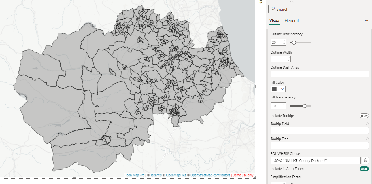
Include in Auto Zoom
The extent of the shape can be included alongside points and shapes from Power BI data when auto-zooming into the map.
Simplification Factor
Whether the features should be simplified to reduce the number of points, improving performance.
Decimal Precision
How many decimal places should be used to represent coordinates. Reducing this will decrease accuracy but may increase performance.
Min Zoom
The zoom level at which the layer starts to be shown.
Max Zoom
The level at which the layer stops being shown.
Z-Index
A number representing the order of the layer relative to other Icon Map Pro layers.